Why Georgia Overland?

In a word, Connectivity. I wish to find all open and legal, unpaved roads in Georgia. The goal is to create a network of dirt, gravel or unimproved roads and trails across Georgia. My focus is on North Georgia, though the project is open to any roads in the state that meet the criteria, and will likely include portions of NW South Carolina, SW North Carolina, SE Tennessee and NE Alabama. If you have a favorite legal trail, track or route you wish to share, and you have no reservations offering it up freely to the world, send an email my way.

Enjoy the journey,

David
David@georgiaoverland.com


Thursday, October 11, 2012

Where is the route I have heard so much about?

Well folks, the route is still not wrapped up and I've been busy enjoying life.  Back in June I mentioned the final scouting trip to areas west of the Cohutta Wilderness.  I'm rather disappointed in what I found and I'm now left with a dilemma.  I originally intended to build an off-pavement route across the northern section of Georgia but I'm finding the gaps between pavement and non-pavement are a bit too large to consider for the route.  Do I link together the bits and pieces of dirt and gravel road, even if there is an undesirable amount of pavement, just to complete the route 'across' Georgia to Alabama?  Or, do I end it on the west side of the Cohuttas and be done with it?   Anyone have any thoughts on this? 

I'm also now considering the creation of a loop into Tennessee and North Carolina, rather than the East-West route I initially intended.  Why not?  Loops are more fun, right? 

Stay tuned and maybe, just maybe, I will get this finished up with a nice set of cleaned up .gpx/.shp/.kmz files to share with everyone.  And perhaps, a fancy printed map too. 

-David


Another reason I have not made more progress is I choose to squander my time doing fun stuff.  Here's a few pics from the 2012 Overland Rally...

On my way to the Rally, I passed this sign.  Scott, this is for you!


What every back road traveller likes to see


Fooling around with the Panorama option on the new iPhone


The Rally was held at Crawford's Campground near Murphy, NC.
Crawford's was a popular launching point for many offroad trips
 prior to the closure of Tellico.
 
Exofficio and Oztent, along with many other vendors,
as they just begin to set up
  
The van gurus of U-Joint Offroad were present


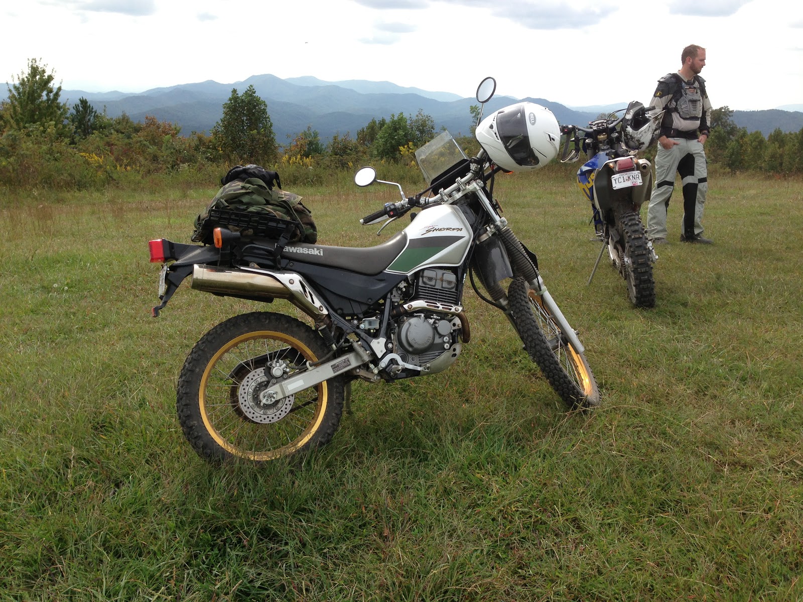
On top of Buck Bald with the dual sport guys.
This was my introduction to dirt and gravel on the Sherpa.

Great bunch of guys.  Duncan, Daniel, Joe and the South Brothers.


Thursday, September 13, 2012

2012 Overland Rally is coming to Murphy, North Carolina on September 27-30th

Come on out for a great weekend of camping and workshops while meeting offroad and travel enthusiasts.

-David


The Overland Rallies and Workshops aim to bring overland and expedition travel enthusiasts together. The event embraces all skill levels of vehicle-based adventure travel and a multitude of vehicles, trucks, 4x4, dual-sports motorcycles, bicycles and more.

The Rally is a family and pet friendly event focusing on training and camaraderie, promoting safe and environmentally sustainable adventure traveling off the beaten path in the US and abroad.

Classes:
•Basic 4WD
•Advanced 4WD
•Spotting
•Synthetic winch line repair
•Motorbike long trip preparation
•Motorcycle Trail riding technic
•First aid
•Spanish phrases for your trip and dos and don’ts in Latin America
•Photography
•Knots and other fun and useful outdoors stuff for kids

Round Tables Discussions:
•International traveling, border crossing
•Traveling with kids
•List to be continued

Evening Presentations:
  • “One Crazy Ride” by Gaurav Jani

  •   1998 Camel Trophy Tierra Del Fuego, presented by Alvaro de Orleans, actual Camel Trophy participant

Registration:

Questions:

Monday, August 20, 2012

Free Film Screening of Gaurav Jani's "One Crazy Ride"

Hello Georgia Overland friends,

I invite you to come on out to Decatur Garage (my friend Daniel Palazzolo's shop) on Sunday, August 26th at 8pm for a special free screening of an amazing film, One Crazy Ride.

Bring a chair and beverage and join us in supporting the work of our very talented filmmaker friend, Gaurav Jani.  One Crazy Ride and Riding Solo to the Top of the World DVDs will be available for purchase as well.  The official announcement and film trailer are below.

For more information about his films, visit http://dirttrackproductions.com/

We hope to see you there!

David


Reader Submission: Old Bucktown Road and Nimblewill Gap Road


I received a trail report for the Old Bucktown Road and Nimblewill Gap Road area from Larry C., owner of a very nicely modded 2009 Hummer H3T.  You may recall seeing his rig before as Larry previously sent a pic of his H3T in the Cohuttas.  His H3T has the Adventure package, which includes front and rear locking differentials, 4.10 gearing and Hill Start Assist.  He added a 2" torsion bar crank in the front, 1" shackle lift in rear, 35" Toyo Mt's, Rancho Shocks, Trail Duty Extended Bump Stops in front, UCP, Rolling Lock Bed Cover, removable Tire Carrier, Cobra 75 WX ST CB Radio and he will be adding a winch soon.  I can't wait to see the H3T in person!  Larry's report and images are below.  As usual, I'm adding this to all reports...

Since I have not verified the accuracy of the descriptions, I feel obligated to state the obvious...Use the following information at your own risk.

Now, on to the report.  Larry writes:

I went up and ran Old Bucktown Road, Forest Service 46 out of Amicalola Falls State Park, and Nimblewill Gap Road today.  Here's a few pics and a brief description of the route I took.

I initially wanted to start on Old Bucktown Road but lost cellphone coverage and my Google Map went down so I missed the turn.  Instead, I started in by going to Amicalola Falls State Park and headed up High Shoals Road / FS 46, there the road starts off paved and turns into gravel once you pass the last set of cabins in the park.  For this section of road a high clearance vehicle is recommended as there are some deep ruts and puddles, but nothing too major where major modifications are needed.
This roads goes for about 3-4 miles and it looks to have been graded within the last year or so which made its pretty easy going, but bumpy. 


After traveling FS 46 for a short time you eventually come out at the junction of Old Bucktown Rd and Nimblewill Gap.  At this point I chose to take the right and check out Nimblewill Gap Rd.  Surprisingly the road is in very good condition with hard packed gravel, the Forestry Dept. must have just graded it because it was easy to go 20-25 mph at some points.  You could even take a car on it driving slowly.

At the junction of Old Bucktown Road, FS 46 and FS 28-2

Turning onto Nimblewill Gap Road

About 5.3 miles of Nimblewill Rd is gravel, three miles of which is hard packed rocky gravel and 2 miles is packed Pea Stone which forms a loose pavement, then the last 5 miles is straight, smooth pavement.  The total road length is about 11 miles.

Nimblewill Gap Road


After I got to the end of Nimblewill Church Rd I still had more time for exploring so I turned around and went back up Nimblewill Gap Rd to the junction where FS 46, FS 28-2, and Old Bucktown Rd meet.  I went down Old Bucktown Rd, and as you had said the road had been graded sometime recently.  You will need to have a high clearance vehicle because it is very rocky and when raining it will be very muddy and will have water running across the road from runoff coming down the mountain.

Beginning of Old Bucktown Road

Old Bucktown Road
About 3.2 miles of Old Bucktown Road is rough gravel and after that the rest (approximately five miles) is paved right up to Roy Rd.  All in all it is a nice easy ride.  In the Fall the views should be pretty spectacular once the leaves fall off the trees because there is a view of the valley for most of the ride.


I hope this info comes in handy to someone, hope to have more soon. Best regards, Larry

Thank you very much, Larry, for taking the time to write the report and send the images.  I'm certain it will be useful to Georgia Overland readers.

-David

Saturday, June 30, 2012

Coming Soon: The Cohuttas and West

Last weekend marked the final Georgia Overland trail scouting trip for the East-West route across North Georgia.  As I anticipated, the off-pavement opportunities are reduced west of the Cohuttas and I am still debating whether to establish the 'end' of the route along the west of the Cohutta and Big Frog Wilderness Loop or to continue the route across a fairly lengthy section of pavement (Eton, Georgia to Johns Mountain WMA) so that I may include dirt and gravel roads along Taylor Ridge.  Over the coming month I will review and format the data captured in this final trip and begin to assemble the complete East-West route in the Fall.  Stay tuned!

The Georgia Overland 1997 Montero at the Mill Creek Overlook,
near Lake Conasauga Campground.

KL250 Super Sherpa: A new addition to the Georgia Overland fleet

After a decade of telling myself  "maybe one day", I finally took the plunge and purchased my first motorcycle.  Meet the 'new' Georgia Overland 2000 Kawasaki KL250 Super Sherpa:

On my way home, the bike and carrier on my trusty 1997 Montero SR

I can't imagine a better name for a small dual-sport bike

The Super Sherpa, waiting for a rider

Now I just need to learn how to ride it!  Thanks to generous friends (Daniel and Bryan), I have a helmet and jacket and soon I will pick up the necessary gloves, pants and boots.  And then the real work begins when I take the motorcycle safety course and begin to figure out this new two-wheel world.

-David


ATL to the Arctic 2012

My friends at ATL to the Arctic are back at it again for the 2012 ride.  This ride for breast cancer awareness and support is now in its third year with two new riders (Gary Lewis and Galen Evans) taking on the challenge of riding from Atlanta, Georgia to Alaska. 

Visit the blog here and donate directly to Susan G. Komen Passionately Pink for the Cure here.

Safe travels to Gary and Galen!

-David

Wednesday, May 16, 2012

Traversing the Atacama Desert in a rented Toyota Hilux 4x4

My good friends, Daniel and Paula, recently rented a Hilux and explored the sand and dirt tracks of Northern Chile.  A flight into Iquique, a drive to Pica and they were off into the lands unknown, traveling through the Atacama Desert along the way.  Daniel sent the following account of their visit to share with the Georgia Overland readers. Enjoy!  -David

About Paula and Daniel
As I sit in Paula's Santiago apartment and look out over the Andes, I try and remember all the small details of the last four days we spent in the Atacama, the driest desert in the world.  I'm still a little tired from our overnight flight from Calama, Chile, back down to Santiago.

First off, let me tell you a few words about myself.  My name is Daniel (Ed. note: his screen name is zolo on the ExpeditionPortal.com Forums) and I have been friends with David a while now.  We met a couple years ago, before my motorcycle trip to the Arctic Circle and Deadhorse, Alaska (Ed. note: visit ATLtotheArctic to learn more about this fantastic ride for the Susan G. Komen Fund).  Since David has been to the Arctic Circle a few times, he was a good resource for information and maps.  Since then, we have been friends and I have been a big supporter of Georgia Overland. I like the site, the maps and the idea of remote off-pavement travel.

Saturday, May 12, 2012

Coming Soon: Traversing the Atacama Desert in a rented Toyota Hilux 4x4

Yes, you read that right.  My good friend Daniel Palazzolo has a story to tell involving a woman, a desert and a diesel Hilux.

Yuma, indeed.


Thoughts on the Adventure Travel Film Festival 2012

Simply fantastic!  I attended the Film Festival last weekend (May 4-6) held at the Nantahala Outdoor Center, which turned out to be the perfect location.  Thanks again to the friendly staff at NOC for pulling the facility-side of this festival together.

The film festival was hosted by the massively interesting and terribly funny adventure travel duo of Austin Vince and Lois Pryce.  It was a genuine pleasure to finally meet and chat with them in person.  Thank you, Austin and Lois! 

Friday, April 20, 2012

Update to the Adventure Travel Film Festival 2012

I posted last month about the unbelievable 2012 Adventure Travel Film Festival arriving May 4-6 in our backyard at the Nantahala Outdoor Center in Bryson City, North Carolina.

If you have not bought tickets, you need to...3 day, 1 day and by the film tickets available so no excuses! This is a once in a lifetime opportunity to see sixteen incredible adventure films, listen to live music, and meet the legendary adventure travellers/filmmakers/writers, Austin Vince (Mondo Enduro, Terra Circa, Roadside USA) and Lois Pryce (Lois on the Loose, Red Tape and White Knuckles) and attend travel and film workshops.

Still don't believe me? Look at this list of films playing May 4-6 (link to descriptions here):

Above and Beyond Dream (2010)
Back of Beyond (1954)
Call of the White (2009)
First Overland (1958)
Grass (1924)
Himalayan Adventure (1958)
Le Grande Detour (2009)
Mazungu (2008)
Mondo Enduro (1995)
Motosyberia (2007)
Paddle to Seattle (2010)
Ride the Divide (2009)
The Headless Valley (1957)
Twice Upon a Caravan (1933)
Wakhan (2009)
Yenisey River Expedition (2001)
And they recently released the film schedule, workshop and presentation specifics so you can plan your visit.

Watch the trailer and tell me this doesn't look like a great time: Adventure Travel Film Festival 2012 Trailer for the Southeast USA.

I'll be there with Georgia Overland decals, so come find me and demand one!

-David

Saturday, April 14, 2012

Reader Submission: Musterground Road and Horsepasture Road

Georgia Overland contributor, Randall Warren, is back with a report from Musterground Road near the North Carolina / South Carolina border.  Randall also sent along some pics from Horsepasture Road.  (Randall first reported on Horsepasture road here).

Since I have neither verified the accuracy of the descriptions nor checked for legal vehicle travel, I feel obligated to state the obvious...Use the following information at your own risk.

First, let's visit Musterground Road...

Randall writes:

This trip originates from one of my two haunts. South Carolina Hwy 11. It can also be accessed from my other haunt, US 64 in NC.

Thursday, March 29, 2012

Daniel, Decatur Garage and ATL to the Arctic

I met Daniel back in 2010, though I knew of the guy for many years as we have a couple friends in common.  It was during the lead-up to his inaugural ATL to the Arctic charity ride to Deadhorse, Alaska that I finally had the opportunity to get to know him.  As co-owner of Decatur Garage, Daniel (or Zolo, as some on the forums know him) turns his highly-skilled wrench on every motorized (and at times, non-motorized) vehicle imaginable.

The Adventure Travel Film Festival 2012 in Bryson City, NC on May 4-6

Great news!  The Adventure Travel Film Festival (All Thanks to Austin Vince and Lois Pryce) is coming to the Southeast during May 4th-6th and it is bringing along a bunch of really fantastic films that you are certain to enjoy.  It will be held nearby in Bryson City, North Carolina.

A brief introduction from the site:
 The Adventure Travel Film Festival is the brainchild of film-maker Austin Vince and travel author Lois Pryce. Here’s how it all came about…

‘Over the last ten years or so we have been sent tons of fantastic travel films from all over the world by largely unknown film-makers. They came from all over the globe and covered every form of transport — boats, bicycles, buses, motorcycles, 4x4s and even hitch-hiking and train-hopping. The ‘adventure travel’ shows we saw on TV, although polished and professional, were nothing in comparison to the real-life dramas that were arriving in our letterbox.

As time passed we gradually realised that we were accruing a fairly extensive and possibly, definitive, collection of adventure travel films. It occurred to us that this had to be the tip of an iceberg. Once we started searching actively, films came to the surface that were absolutely mind-blowing. We were amazed, and excited, that adventures of this quality, old and new, were essentially unknown by the public.

Our mission is to change all that.

Film festivals don’t usually have manifestos — so here’s ours!

1.To showcase the best independent adventure travel films ever made

2.To guarantee a platform for future adventure film-makers

3.To bring together the adventure travel community

4.We know that making a good film isn’t difficult — we will show you how

5.To have loads of fun while doing all the above!
Film festivals are usually based around cinema screens in cities. In the spirit of the event, the Adventure Travel Film Festival is based around two days of camping and good times in beautiful countryside.

We look forward to seeing you there!
To learn more, visit the Adventure Travel Film Festival Site.

Enjoy,
David

Sunday, March 25, 2012

Road System Study set to begin on the Chattahoochee National Forest

I received a link to this last week.  Somehow I missed hearing about this, so I owe Nathan a big 'Thank You' for emailing me and letting me know.  Anyone interested in traveling on roads in the Chattahoochee National Forest should give this a look and express your interest that roads remain open.  This Road Study needs your input by April 13th.

I strongly encourage you to learn more by visiting the main Public Input page here:  Forest Service Seeks Your Input 

The Comment Form may be accessed directly here:  Chattahoochee National Forest Public Input

The site text is as follows
The Forest Service is committed to balancing your needs for access to the Chattahoochee National Forest with our responsibility to sustain a productive, diverse and healthy forest. As part of this commitment, we must address crucial concerns about the future sustainability of the national forest road system. The three Ranger Districts that make up the Chattahoochee National Forest are beginning a study of the road system, and we need your input.


This transportation study will help us find a way to use our limited resources to balance the needs for access to the forest with the protection of clean water and a healthy forest. The transportation study is not a proposal or decision, but is intended to help guide us in planning future road management.

The number of overdue road maintenance projects continues to grow, while public use of our roads is increasing. Roads that cannot be adequately maintained can be dangerous to visitors and threaten forest health. They can increase sedimentation into rivers and streams, degrading water quality and impacting fish and wildlife.

Possible options that may be considered for each road include:
Maintaining at the current standard

Changing the level of maintenance (ex., from passenger car to high-clearance vehicle)

Adding seasonal restrictions

Implementing year-long closures

Decommissioning
We need to hear from you by April 13

We want to learn from you which roads are important to you and why. We will consider your input along with other factors including management access needs, benefits, risks and costs. Before any actions are taken we will provide more opportunities for you to participate in the decision making process.

Use our online comment form to view maps and provide your input to us. You may also find hardcopy planning maps and comment forms at the local Ranger District and Forest Supervisor's offices. We will consider all comments received before April 13, after which the official comment period for this first phase of the study will close. Your input is very valuable to us, and we thank you in advance for your time and thoughtful comments.
Let's all provide thoughtful, useful comments to the USDA/Forest Service regarding the roads in the Chattahoochee National Forest.

Thanks!

Friday, March 23, 2012

Reader Submission: Pisgah East

I heard from our friend Randall again and this time he shares his notes following his exploration of 'Pisgah East'.

As always, I have neither verified the accuracy of the descriptions nor checked for legal vehicle travel, I feel obligated to state the obvious...Use the following information at your own risk.

Randall writes:

This is FR 477 to FR 1206 starting in Brevard and ending in the North Mills Recreation Area. FR 5000 out of North Mills will take you to Lake Powhatan. I'll try to add this on at some point in time, when I can check it out. FR 477 is about eight miles long, FR 1206 is about 8.5 miles and FR 5000 appears to be about 7-8 miles, so combined that would be about 25 miles of gravel road with a minimum of pavement.

Saturday, March 17, 2012

Reader Submission: Larry C. and his H3T

Last week I received an email and pics from Larry following his exploration of the Cohutta WMA in the Chattahoochee National Forest.   Thanks for sharing the pictures and I look forward to hearing your thoughts on 'The Loop' when you finish it.

Larry's H3T


Tuesday, February 7, 2012

Reader Submission: Pisgah National Forest from Balsam Grove, NC to Brevard, NC

On Thursday, 2/2/12, I received a new trail report from our (quickly becoming!) regular contributor, Randall Warren.  Randall explored an area in the Pisgah National Forest, in Southwestern North Carolina, from Balsam Grove to the Fish Hatchery in Brevard. 

As always, I have neither verified the accuracy of the descriptions nor checked for legal vehicle travel, I feel obligated to state the obvious...Use the following information at your own risk.

And now, I give you Randall:

From Rosman, North Carolina, take NC 215 ten miles north to the community of Balsam Grove.  Less than a mile north out of Balsam Grove, turn right on State Road 1321, also known as Indian Creek Road.

Friday, February 3, 2012

First Overland and a tribute to Antony Barrington-Brown

One of my favorite travel books is First Overland, written by Tim Slessor and published in 1957.  It chronicles the 1955 Oxford & Cambridge Far Eastern Expedition from London to Singapore.  One member of the expedition, Antony Barrington-Brown (known as BB), was the expedition's photographer and filmmaker.  Last month, both BB and his wife, Althea, were killed in a car accident near their home in Wiltshire, England.

Below is a link to Graeme Aldous' tribute to BB and his wife via his First Overland Newsletter (note, current newsletter content will change so you may need to view his archived newsletters if you read this post late).  Graeme created an excellent DVD documentary of the First Overland story.  His tribute offers some insight into the lives of BB and Althea.

http://www.teeafit.co.uk/firstoverlandnewsletter/

Godspeed BB and Althea.

-David

Friday, January 27, 2012

Reader Submission: Dupont State Forest

Georgia Overland Contributor, Randall Warren, is at it again. I received the following information regarding a ride he enjoyed in the Dupont State Forest. And as I stated in earlier posts, since I have neither verified the accuracy of the descriptions nor checked for legal vehicle travel, I feel obligated to state the obvious...Use the following information at your own risk. With that out of the way, I give you Dupont State Forest from Randall Warren:

Here's some info on Dupont. It's located in the community of Cedar Mountain off Highway 276. It's about twenty minutes from Brevard, North Carolina and one hour from Greenville, South Carolina.
Take Cascade Lake Road off Highway 276. Go about 500 feet and turn right on Reasonover Road. This goes for about 2.5 miles then splits. Pinnacle Mountain Road goes left and Green River Road continues straight.

Tuesday, January 17, 2012

Rich Mountain WMA to the Cohutta and Big Frog Wilderness Loop

This collection of a few dirt and gravel roads is an attempt to capture as many off-pavement opportunities as possible for visitors as they transit between Rich Mountian and the Cohutta and Big Frog Wilderness Loop.

Download the Rich Mountain WMA to the Cohutta and Big Frog Wilderness Loop .kmz file.

View the Rich Mountain WMA to the Cohutta and Big Frog Wilderness Loop .kmz file in Google Maps.

Monday, January 16, 2012

Rich Mountain WMA to Coopers Creek WMA

This section connects portions of the previously captured in the West Wolf Creek Rd to Georgia Highway 60 file. It adds portions of road to the Coopers Creek WMA, as well as a remote section of dirt and gravel trail (FS 640 and Old Dial Rd) that runs nearly unbroken from Skeenah Gap Rd in the east, crosses Georgia Highway 60 / Morganton Highway, and continues to the Shallowford Bridge in the west. Also found in this section is the Toccoa River Canoe Launch at Sandy Bottom, a variety of hiking trails, and a waypoint to a really interesting 'Swinging Bridge' found along the Benton MacKaye Trail.

Download the Rich Mountain WMA to Coopers Creek WMA .kmz file.

View the Rich Mountain WMA to Coopers Creek WMA .kmz file in Google Maps.